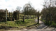
Grassmoor, Hasland and Winsick
Civil parish in Derbyshire, EnglandGrassmoor, Hasland and Winsick is a civil parish within the North East Derbyshire district, which is in the county of Derbyshire, England. Named for local settlements, with a mix of a number of villages and hamlets amongst a semi-rural area, it had a population of 3,360 residents in 2011. The parish is 130 miles (210 km) north west of London, 20 miles (32 km) north of the county city of Derby, and 2 miles (3.2 km) south east of the nearest market town of Chesterfield. It shares a boundary with the borough of Chesterfield, along with the parishes of Calow, North Wingfield, Temple Normanton, Tupton as well as Wingerworth. The parish paradoxically does not include the majority of the nearby built-up suburb of Hasland which is now within an adjacent unparished area of Chesterfield.


